- New
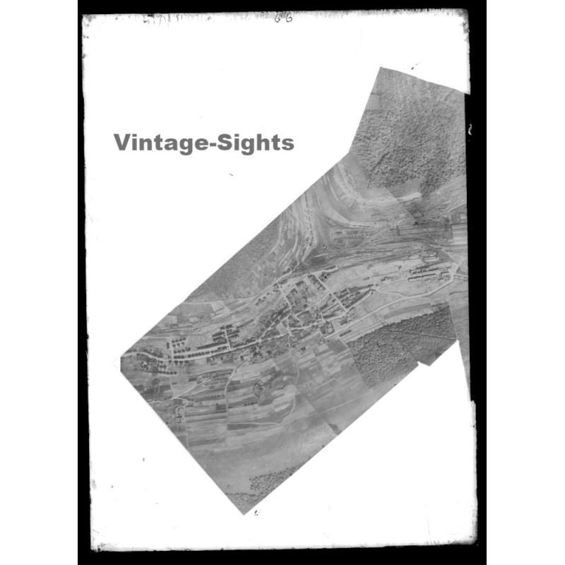


spectacular and very large original historical military glass plate negative measuring approximately 18 x 13 cm. this rare half plate master record is an official world war i military archive photograph documenting an early aerial photomosaic mosaic mapping composite.
the high-resolution vertical view shows a series of overlapping aerial reconnaissance photographs taken from a scouting aircraft, precisely cut and assembled onto a mounting board. this advanced photogrammetric technique was used by aerial intelligence units to create seamless, detailed photographic maps of strategic terrain, featuring a deep river valley, a large railway junction station, industrial complexes, agricultural fields, and a rural town settlement bordered by dense forests.
the upper edge of the negative features subtle handwritten military archival inventory marks.
the glass plate is in very good vintage condition with outstanding definition and exceptional contrast, keeping every single seam of the composite map perfectly visible. a premier museum-grade piece for advanced collectors of early cartography, aviation history, military intelligence tactics, and photogrammetry during the first world war.
size: ~ 18 x 13 cm (1 cm ~ 0.39 inch)
condition: very good...please also refer to scans which show complete glass plate
photography, fotografie, positive, glasdia, glas dia, glas negatif, photography, ww1 glass negative, world war i, 1914 1918, ww1 aerial photo, photomosaic, aerial mapping, glass plate negative, 18x13 cm, large format negative, half plate glass, photogrammetry, military intelligence, composite map, reconnaissance flight, topography, railway infrastructure, original negative, aviation archive, unikat

Data sheet
Specific References